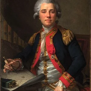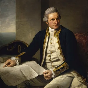

British navigator, cartographer and explorer (1728–1779), James Cook led three major expeditions into the Pacific Ocean and greatly advanced the world's geographical knowledge. He explored and mapped New Zealand, Australia, and numerous Pacific archipelagos, becoming one of the defining figures of modern exploration.
James Cook(1728 — 1779)
James Cook
royaume de Grande-Bretagne
8 min read
Frequently asked questions
Key Facts
- 1768–1771: First Pacific expedition aboard the Endeavour, exploration of New Zealand and the eastern coast of Australia
- 1772–1775: Second expedition — circumnavigation and crossing of the Antarctic Circle
- 1776–1779: Third expedition into the North Pacific Ocean and search for the Northwest Passage
- 1779: Death in Hawaii during his third expedition
- Creation of groundbreaking, highly accurate maps of the Pacific and advances in navigation methods and scurvy prevention
Works & Achievements
Cook drew the first accurate and complete charts of both islands of New Zealand. These charts, remarkably precise for their time, remained the reference for navigators for over a century.
During the first voyage, Cook surveyed and charted nearly 4,000 km of Australian coastline, paving the way for British colonisation of the continent.
Official publication of the account of the first voyage, compiled from the journals of Cook and botanist Joseph Banks. The work was an immense success in Europe and spread knowledge of the peoples of the Pacific.
Account of the second voyage written by Cook himself. In it he describes his Antarctic explorations and concludes that there is no easily accessible southern continent, correcting a centuries-old geographical belief.
Posthumous publication of the account of the third voyage, completed by Captain James King. It contains the first detailed description of the Hawaiian Islands and the north-west coasts of America.
During the third voyage, Cook explored and charted the coasts of Alaska and the Bering Strait with the aim of finding an arctic sea passage connecting the Pacific to the Atlantic.
Anecdotes
During his first voyage (1768-1771), Cook had a secret mission from the British Admiralty: after observing the transit of Venus from Tahiti, he was to open a sealed envelope ordering him to search for the mysterious southern continent, the "Terra Australis Incognita". This dual mission illustrates the blend of science and imperial ambition that characterized the expeditions of the era.
Cook was one of the first commanders to understand that scurvy — a disease that decimated crews at sea — could be prevented through a varied diet. He required his sailors to eat sauerkraut, citrus fruits, and fresh vegetables at every port of call, drastically reducing mortality on board. This revolutionary practice earned him a medal from the Royal Society in 1776.
During his second voyage (1772-1775), Cook crossed the Antarctic Circle for the first time in the history of navigation, in January 1773. His ships, the Resolution and the Adventure, carved their way through the ice, but never catching sight of the Antarctic continent itself, which conditions made inaccessible.
In Hawaii, during his third and final voyage, Cook was initially welcomed as a god by the inhabitants, coinciding with a religious festival. But upon his return a few weeks later, an altercation broke out over the theft of a canoe. On February 14, 1779, Cook was killed on the beach at Kealakekua Bay, at the age of 50, in a skirmish between his men and the Hawaiians.
Primary Sources
We had now made the circuit of the globe in these southern latitudes... and I flatter myself that no one will think that I have left it much to the advantage of any future navigator.
The observations of the transit of Venus were made with as much accuracy as the nature of the instrument admitted of, and I have the satisfaction to believe that the phenomenon was observed to the advantage of astronomy.
I had now made the circuit of the Southern Ocean in a high Latitude and traversed it in such a manner as to leave not the least room for the possibility of there being a continent, unless near the Pole.
The introduction of Sour Krout into the Navy will be attended with good effects, as the crew of the Resolution can testify, not a man having been troubled with Scurvy during the whole Voyage.
Key Places
Location for observing the transit of Venus in 1769 during the first voyage. Cook established relations with the inhabitants and produced a detailed chart of the island.
Bay where the Endeavour landed in April 1770, marking the first documented European contact with the eastern Australian coast. Botanist Joseph Banks collected hundreds of previously unknown plants there.
Cook circumnavigated and charted both islands of New Zealand between 1769 and 1770, establishing that they were not part of a vast southern continent.
Bay where Cook was welcomed as a hero during his final voyage, and where he was killed on 14 February 1779 during a violent altercation with the inhabitants.
Port where the young Cook served his apprenticeship as a sailor in the coal trade. The type of vessel he learned to handle there — the bark — inspired the choice of the Endeavour for his first voyage.
Liens externes & ressources
Références
Œuvres
Cartes hydrographiques de la Nouvelle-Zélande
1769-1770
Cartographie de la côte est de l'Australie
1770
An Account of the Voyages undertaken... (récit du 1er voyage, par John Hawkesworth)
1773
A Voyage towards the South Pole and Round the World (2e voyage)
1777
A Voyage to the Pacific Ocean (3e voyage, posthume)
1784
Cartographie du détroit de Béring et des côtes d'Alaska
1778