
Greek astronomer, mathematician, and geographer of the 2nd century, he developed a geocentric model of the universe that would dominate scientific thought for over 1,400 years. His encyclopedic work synthesizes ancient knowledge in astronomy, geography, and optics.
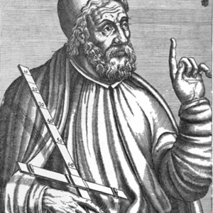
Claudius Ptolemy(100 — 170)
Claudius Ptolemy
Rome antique
7 min read
Frequently asked questions
Key Facts
- Around 150 AD: composition of the Almagest, a landmark astronomical treatise laying out the geocentric system
- Around 150 AD: composition of the Geography, a cartographic work in 8 books with coordinates for 8,000 locations
- His geocentric model (Earth at the center of the universe) remained dominant until Copernicus in the 16th century
- He worked at the Library of Alexandria, the foremost intellectual center of the ancient world
- His works on optics and music were also standard references throughout the Middle Ages
Works & Achievements
An astronomical encyclopedia in 13 books laying out the geocentric model of the universe. A standard reference in astronomy for over 1,400 years, it was translated into Arabic and then Latin, passing Greek science on to the Middle Ages.
A treatise in 8 books providing the geographical coordinates of nearly 8,000 locations, along with a cartographic projection system and instructions for drawing world maps. Rediscovered during the Renaissance, it directly inspired the Age of Exploration.
An astrological treatise in 4 books that systematizes the supposed influence of celestial bodies on people and nations. A foundational text of Western astrology, it remains a valuable source on how the ancient world understood the cosmos.
A treatise in 5 books studying vision, mirrors, and the refraction of light. Ptolemy carried out experimental measurements of refraction angles, anticipating work that would later be attributed to Ibn al-Haytham.
A treatise on music theory linking musical intervals to mathematical ratios and the movements of the celestial spheres. It reflects Ptolemy's encyclopedic ambition to find universal laws governing every field of knowledge.
A treatise describing the stereographic projection of the celestial sphere onto a flat surface. This text forms the theoretical foundation for the construction of astrolabes, instruments that would dominate medieval astronomy.
Anecdotes
Ptolemy lived in Alexandria, the intellectual capital of the ancient world, home to the greatest library ever assembled. It was in this exceptional setting that he was able to synthesize centuries of Babylonian and Greek astronomical observations to construct his model of the universe.
His geocentric model, presented in the Almagest, was so accurate in predicting planetary positions that it was used without serious challenge for fourteen centuries, until Copernicus proposed a heliocentric model in 1543. The precision of Ptolemy's calculations rested on the ingenious use of epicycles and deferents.
His Geography contained the coordinates of nearly 8,000 locations in the known world, from Ireland to the coasts of Southeast Asia. Although some distances were incorrect — most notably his underestimation of Earth's circumference — these maps guided navigators and explorers well into the Renaissance.
Ptolemy is one of the first scholars to have written a comprehensive treatise on optics, studying the refraction of light through different media. He conducted experiments by submerging objects in water and measuring refraction angles, anticipating by several centuries work that would long be attributed to medieval Arab scholars.
Primary Sources
The Earth is at the center of the universe, motionless, and the stars revolve around it in uniform circular motion. The planets move on epicycles whose centers travel along deferents centered on the Earth.
We shall set out the principles of mathematical geography, then enumerate the peoples, cities, mountains, rivers, and seas with their respective latitudes and longitudes, so that a representation of the inhabited world may be drawn.
The influence of celestial bodies on earthly beings is manifest: the sun warms, the moon moistens, and the planets, through their respective positions, alter the temperaments and destinies of men and nations.
When a visual ray passes from a less dense medium into a denser one, it bends toward the perpendicular at the point of contact between the two media. We have measured these angles for air, water, and glass.
Key Places
The main city where Ptolemy worked, home to the Museum and the Library. It was here that he carried out all of his observations and wrote his major works.
A unique intellectual institution from which Ptolemy drew on the work of his Greek predecessors (Hipparchus, Eratosthenes) and Babylonian scholars. It represents the continuity of ancient science.
The island where Hipparchus worked in the 2nd century BCE, whose observations and star catalogue served as the primary source on which Ptolemy relied when building the Almagest.
A city whose astronomers had accumulated centuries of planetary observations. Ptolemy incorporated this Babylonian data into his own calculations, ensuring a millennia-long scientific continuity.
The political capital of the Empire in which Ptolemy lived and worked. The Pax Romana ensured the free movement of knowledge and scholars between East and West.