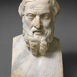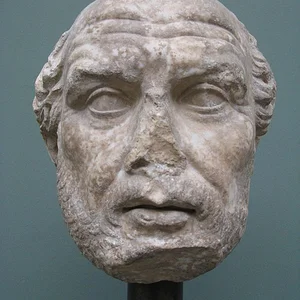

A Greek navigator and geographer from Massalia (Marseille), Pytheas undertook an extraordinary voyage around 325 BCE toward northern Europe, reaching the mysterious island of Thule. He was one of the first to give a scientific description of tides and the Arctic regions.
Pytheas(358 av. J.-C. — 288 av. J.-C.)
Pytheas
9 min read
Frequently asked questions
Key Facts
- Around 325 BCE: departure from Massalia (Marseille) on an exploratory voyage toward northern Europe
- First Greek to describe the British Isles and mention the frozen sea
- Reached an island called Thule, most likely Norway or Iceland
- Observed and scientifically described the phenomenon of tides, linking them to the Moon
- His accounts, dismissed as implausible by his contemporaries, were nonetheless confirmed later on
Works & Achievements
Pytheas's principal work, recounting his great voyage to northern Europe and his geographical and astronomical observations. Lost in its entirety, it is known only through quotations in Strabo, Pliny the Elder, and Diodorus Siculus.
An astronomical study in which Pytheas determined the latitude of his hometown with remarkable precision using a gnomon. This rigorous scientific result reflects his training in the Greek mathematical tradition inherited from Eudoxus of Cnidus.
The first Greek scientific account of the powerful tides of the Atlantic Ocean and their correlation with the phases of the Moon. This remarkable insight, preserved by Pliny and Geminus, did not receive a complete physical explanation until Newton.
Pytheas was the first Greek writer to describe the phenomenon of the midnight sun in sub-polar regions, as well as the near-continuous winter nights. These observations, dismissed as implausible by his contemporaries, are today recognized as entirely accurate.
Anecdotes
During his voyage north, Pytheas described a mysterious substance he called “sea lung” (pneumôn thalassês), a mixture of water, earth, and air in which one could neither walk nor sail. Historians today believe he was most likely describing sea ice or Arctic brash ice — a strikingly accurate description for the time.
Pytheas was one of the first Greek scholars to draw a scientific connection between the tides and the Moon. He observed that the great tides along the Atlantic coastline coincided with the full moon — a discovery his contemporaries found so implausible that many refused to believe him. This insight would not find its full explanation until Newton's law of gravitation in the 17th century.
Upon his return, Pytheas was accused of being a liar by the geographer Strabo, who dismissed his accounts of frozen lands and endless nights as pure fantasy. Polybius called him a fraud. Yet his descriptions of Britain, the tides, and the midnight sun have proved remarkably accurate over the centuries.
Before setting out, Pytheas accurately calculated the latitude of Massalia using a gnomon — a simple vertical rod whose shadow he measured at noon. He arrived at a value very close to reality (43°, compared to the actual 43.3°), showing that he was first and foremost a rigorous astronomer as much as an adventurous navigator.
Pytheas was probably the first Greek to describe Britain (which he called Prettanike) and to sail around it. He noted that its inhabitants grew wheat, produced a fermented barley drink, and lived in round wooden houses. These observations constitute the earliest written accounts of the Celtic peoples of Britain.
Primary Sources
Pytheas, who has misled many people, claims to have personally traveled the whole of Britain on foot, and gives the island a circumference of more than 40,000 stades.
Pytheas reports that Thule is the northernmost known island, and that there, in summer, the sun never sets. He also mentions a coagulated sea — neither land, nor sea, nor air — which cannot be crossed on foot or by boat.
Pytheas, who sailed along the whole of Britain, says the island is triangular like Sicily and names its three main capes. Its inhabitants harvest grain in covered barns, as there is not enough sun to thresh it in the open air.
Pytheas of Massalia states that in the northernmost regions, summer nights are so short that barely two hours separate sunset from sunrise, which matches observations from subpolar zones.
Sailors from Massalia had once traveled these shores beyond the Pillars of Hercules, exploring lands no Greek before them had ever set foot on, sailing northward along the Iberian and Gallic coasts.
Key Places
A Phocaean Greek colony founded around 600 BC, Massalia was Pytheas's birthplace and the departure point for his expedition. A prosperous trading city with close ties to Gaulish peoples, it possessed an intellectual and scientific tradition that allowed Pytheas to receive his education.
A Phoenician port at the Pillars of Hercules, on the edge of the known Mediterranean world. Pytheas likely stopped here before venturing into the Atlantic Ocean, symbolically crossing the boundary between the familiar world and the unknown.
The archipelago that Pytheas was the first Greek to explore and describe systematically. He estimated its coastal perimeter, described the customs of its Celtic inhabitants, their production of tin, and their farming practices.
A mysterious island described by Pytheas as the northernmost point of his journey, six days' sail north of Britain. There, he observed the midnight sun and a frozen sea. The name Thule has since become synonymous with the ends of the earth in Western culture.
On his return journey, Pytheas likely sailed along the North Sea coastline and mentioned a region that produced amber, most probably the Baltic shores. These observations are among the earliest Greek descriptions of the Germanic peoples.
Typical Objects

A vertical rod planted in direct sunlight whose shadow is measured at noon. Pytheas used one to calculate the latitude of Massalia with remarkable precision, and continued his measurements throughout his voyage to observe how the sun's altitude varied with latitude.

A common writing medium in ancient Greece, used for taking quick notes at sea. Pytheas likely recorded his observations on tides, stars, and the peoples he encountered on these tablets before transcribing them onto papyrus upon his return to Massalia.

Terracotta containers used to transport olive oil, wine, and provisions for long voyages. Pytheas's ship carried large quantities of them to feed the crew and use as trade goods with the coastal peoples they encountered.

The medium on which Pytheas composed his work *On the Ocean* after his return. This text, now lost in its entirety, has survived only as fragments quoted by later authors such as Strabo, Pliny the Elder, and Diodorus Siculus.

Greek ships used lead-weighted anchors to stop in coves and harbors along their route. Pytheas would regularly make landfall to observe local populations, take astronomical measurements, and piece together the geography of the coastlines he visited.

An instrument representing the major celestial circles (equator, ecliptic, tropics) used by Greek astronomers to model the motion of celestial bodies. Pytheas referred to it to interpret the unusual positions of the sun at the northern latitudes he was discovering.
School Curriculum
Vocabulary & Tags
Key Vocabulary
Daily Life
Morning
Pytheas rose at dawn to observe the position of the sun using his gnomon, noting the angle of the shadow on his measurement table. In his workshop at Massalia, he compared these observations with those of previous days to refine his latitude calculations. When the sky was clear, he drew preliminary maps of the regions he planned to explore, or described them in his writings.
Afternoon
Afternoons were devoted to writing up his notes and to discussions with the Phoenician and Greek merchants who frequented the port of Massalia, who provided him with information on the trade routes for tin and amber. At sea, these hours were dedicated to active navigation, interpreting winds and currents, and exchanging with the coastal populations he encountered.
Evening
At sunset, Pytheas observed the stars and their position on the horizon to determine his geographic latitude. On board his ship, he verified the heading with his crew and planned the following day's leg of the journey. Back in Massalia, he took part in scholarly symposia where he presented his theories on the Ocean and the sphericity of the Earth.
Food
Pytheas's diet was that of a prosperous Greek from Massalia: barley or wheat bread, olives, sheep's cheese, Mediterranean fish, and wine mixed with water. At sea, his provisions were reduced to dry goods — flatbreads, dried pulses, dried fish — supplemented by fishing from the side of the boat. He observed with curiosity that the Britons consumed a fermented barley drink and wild honey, products wholly unknown on Greek tables.
Clothing
In Massalia, Pytheas wore the *chiton* (a linen tunic) and the *himation* (a large woolen cloak draped over the shoulder), the standard attire of prosperous Greek citizens. At sea or in northern regions, he had to adapt to the cold with thicker woolen cloaks similar to those worn by the Gauls he encountered. He described with astonishment the fur garments worn by the peoples of the regions near Thule.
Housing
In Massalia, Pytheas most likely lived in a Greek house organized around a central atrium open to the sky, with rooms set aside for his measuring instruments and papyrus scrolls. At sea, he shared the cramped life of the ship with his crew, sleeping on deck or under a simple awning. He noted that the Britons lived in round houses built of wood and covered with thatch, very different from the stone dwellings of the Mediterranean world.
Historical Timeline
Period Vocabulary
Liens externes & ressources
Références
Œuvres
Sur l'Océan (Περὶ τοῦ Ὠκεανοῦ — Peri tou Okeanou)
Vers 320 av. J.-C.
Calcul de la latitude de Massalia
Avant 325 av. J.-C.
Description des marées atlantiques et de leur lien avec la Lune
Vers 325-320 av. J.-C.
Observations sur le soleil de minuit et les zones arctiques
Vers 325 av. J.-C.