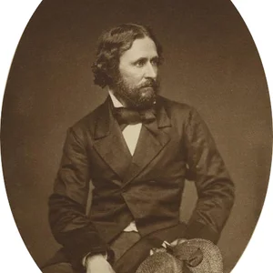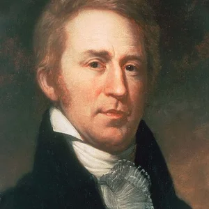

Lewis and Clark led the Corps of Discovery expedition (1804–1806), commissioned by President Jefferson to explore the Louisiana Territory all the way to the Pacific. They were the first Americans to cross the continent from east to west, paving the way for westward expansion.
Lewis and Clark
Lewis and Clark
8 min read
Frequently asked questions
Key Facts
- 1803: Jefferson commissions the expedition following the purchase of Louisiana from Napoleon
- 1804: departure from Camp Dubois (Missouri) with 33 members of the Corps of Discovery
- 1804–1805: winter among the Mandan people (North Dakota) with Sacagawea as guide and interpreter
- 1805: crossing of the Rockies and reaching the Pacific in November
- 1806: return to St. Louis, bringing back maps, journals, and previously unknown scientific specimens
Works & Achievements
The daily journals written by Lewis and Clark constitute the first scientific description of the American West, documenting 178 plant species, 122 animal species, and ethnographic information on approximately fifty Native American nations.
William Clark produced remarkably accurate maps covering the Missouri River basin and the Columbia River. These maps remained the standard geographic references for the American West for several decades and guided subsequent generations of explorers and settlers.
Lewis and Clark documented the languages, customs, social organizations, and territories of approximately 50 Native American nations. These observations constitute a foundational ethnographic source on the peoples of the West before large-scale colonization.
The first official publication of the expedition's accounts, edited by Nicholas Biddle. This work revealed to the American and European public the wealth of the West, directly fueling the policy of expansion toward the Pacific and the doctrine of Manifest Destiny.
Anecdotes
Meriwether Lewis owned a large Newfoundland dog named Seaman, which he had purchased for 20 dollars in Pittsburgh before departure. This faithful companion traveled the entire 12,000 kilometers of the expedition and appeared several times in Lewis's journals, notably during an encounter with beavers he was hunting for the crew.
The encounter with grizzly bears left the explorers stunned. Accustomed to the black bears of the American East, the men of the Corps of Discovery discovered that grizzlies could absorb several bullets before going down and charged without hesitation. Lewis noted in his journal that he would rather face two hostile Indians than a single grizzly.
Sacagawea, a young Shoshone woman of around 16 who had just given birth, played a decisive role during the crossing of the Rockies in 1805. When the expedition encountered a Shoshone tribe to negotiate for horses essential to crossing the mountains, the chief turned out to be Sacagawea's own brother — an extraordinary coincidence that facilitated the negotiations and perhaps saved the expedition.
On November 7, 1805, William Clark noted in his journal: “Great joy in camp — we are in sight of the Ocean, that long-awaited Ocean.” After 18 months of travel from St. Louis, the crew finally glimpsed the Pacific, having crossed an entire continent for the first time in American history.
To choose the location of the winter fort in 1805, Lewis and Clark made a remarkable decision for the time: they consulted all members of the expedition through a vote, including York, Clark's enslaved Black man, and Sacagawea. It is one of the earliest votes in American history in which a woman and an enslaved person had a say.
Primary Sources
The object of your mission is to explore the Missouri river, and such principal streams of it, as may offer the most direct and practicable water communication across this continent for the purposes of commerce.
I paused for a moment in the middle of the river at sunset to contemplate with joy the vastness of the country we are about to explore. We are all in good health, well equipped, and fully determined to accomplish our duty.
Great joy in camp, we are in view of the Ocean, that long-awaited ocean, the sight of which filled us with such great pleasure and so much satisfaction after the painful hardships and the many difficulties we were forced to endure.
The expedition journals constitute the first scientific and geographical description of the American West, documenting 178 new plant species and 122 animal species previously unknown to Western science.
Key Places
Starting point of the expedition on May 14, 1804, and the site of the triumphant return in September 1806. St. Louis was then the gateway to the western territories, a frontier city at the confluence of the Missouri and Mississippi rivers.
Winter camp of 1804–1805, built near the Mandan villages on the Missouri River. It was here that Lewis and Clark recruited Sacagawea as interpreter and guide, and sent their first scientific reports to Jefferson.
The highest point of the Rocky Mountain crossing in August 1805. Upon reaching this pass, Lewis became the first American citizen to cross the Continental Divide and realized there was no direct water route to the Pacific.
Winter camp of 1805–1806 on the Pacific coast, near present-day Astoria. For four months in relentless rain, the team prepared for the return journey, traded with local tribes, and completed their scientific journals.
The expedition's final destination, reached in November 1805. Clark carved into a coastal pine: "William Clark, December 1805. By land from the United States of America," symbolically marking the first American transcontinental crossing.
Typical Objects

Lewis had received training in astronomy before departure. The sextant and compass allowed him to record geographical coordinates with remarkable precision, enabling Clark to draw the first reliable maps of the American West.

Lewis and Clark kept daily leather-bound journals in which they recorded botanical, zoological, ethnographic, and geographical observations. These notebooks stand as a primary scientific and historical source, documenting 300 newly identified species.

Jefferson provided the expedition with calumets to present to Native American chiefs during diplomatic meetings. Smoking the calumet signified the opening of peaceful dialogue and was respected by all the indigenous nations of the region.

Every man in the Corps of Discovery was armed with a Harper's Ferry model flintlock rifle. These weapons were used primarily for hunting to feed the team, and impressed Native American nations with their rate of fire and accuracy.

The expedition carried colored beads, mirrors, blankets, and medals bearing Jefferson's likeness. These objects served as trade currency to obtain food, geographical information, and horses from the Native American peoples they encountered.

A 17-meter keelboat transported the team and its equipment up the Missouri River during the first months. This vessel carried trade goods, weapons, scientific instruments, and provisions, forming the logistical backbone of the expedition's first phase.
School Curriculum
Vocabulary & Tags
Key Vocabulary
Tags
Daily Life
Morning
Wake-up came at dawn, before sunrise. Lewis made astronomical observations with the sextant to establish the camp's geographic coordinates. The team then dismantled the shelters, loaded the boats, and set off again before the heat or insects became unbearable.
Afternoon
Traveling by boat on the rivers, the men rowed or pushed with poles against the sometimes fierce Missouri current. In the Rockies, they made their way on foot along steep trails, guided by Sacagawea. Lewis regularly stopped to collect unknown plants, sketch animals, and record his observations in his journal.
Evening
Camp was set up before nightfall on a raised riverbank for safety. Sentinels kept watch throughout the night. The cook prepared a meal from game hunted during the day. Lewis and Clark wrote in their journals by candlelight, meticulously compiling the day's scientific, geographic, and ethnographic data.
Food
The diet varied according to the regions traveled through. On the Missouri, the team hunted bison, deer, and beaver in abundance. In the Rockies, food became scarce and the men sometimes had to eat their pack horses. On the Pacific coast, fish, camas roots, and dog meat purchased from coastal tribes formed the basis of their winter diet.
Clothing
The military uniforms worn at departure were quickly replaced by buckskin outfits sewn in the Native American style, far better suited to the terrain and climate. Moccasins replaced military boots. Sacagawea and the women of local tribes made and repaired clothing throughout the journey.
Housing
At night, the team slept in the open or under rudimentary shelters of branches and hides, depending on the weather. During the two winters, they built log forts (Fort Mandan, Fort Clatsop) consisting of several cabins arranged in a square around a central courtyard, with covered roofs to withstand the Dakota cold or the relentless rain of Oregon.
Historical Timeline
Period Vocabulary
Liens externes & ressources
Références
Œuvres
Journaux du Corps of Discovery
1804-1806
Cartes de l'Ouest américain (Clark)
1806-1810
Rapport diplomatique sur les nations amérindiennes
1806
History of the Expedition under the Command of Captains Lewis and Clark (édition Biddle)
1814